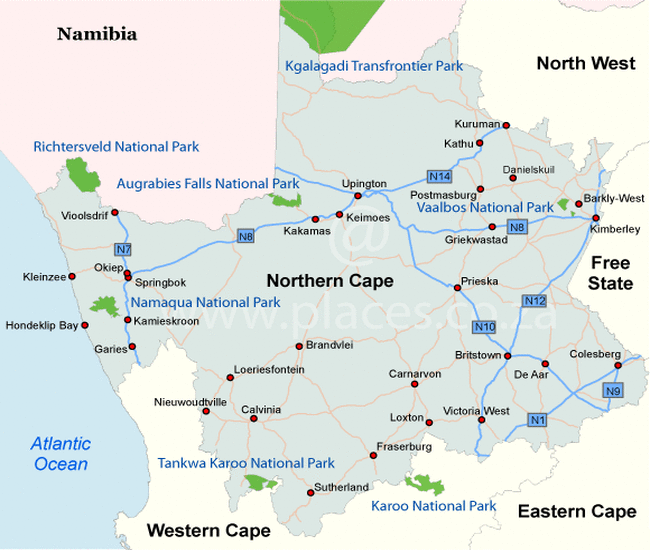
Northern Cape
Climate in the Northern Cape
The Northern Cape has extreme climates. In the summer it can become more than 40 ° C in the deserts during the day and light freezing at night. It barely rains there, but if something falls it is mainly in the west. This rain creates a large sea of flowers in early spring in Namaqualand.
Capital
Kimberley is the capital of the Northern Cape and is also called the “Diamond Capital of the World.” The city is located in the middle of South Africa and is often visited when traveling between Johannesburg and Cape Town. In Kimberly there are several historical attractions that take you back to the time of the diamond fever, late 19th century. Especially when you step into one of the old pubs with dark, smoky interiors with damaged wooden tables and old Castle Lager posters still hanging on the wall, you get the feeling that people were stuck here during the diamond age. The story goes that in 1871 a group of gold diggers were camping at this place and a cook was sent away because of a minor offense. A moment later he came back with a diamond.
Kimberly is still synonymous with the mining industry and diamonds are mined here. In the street pattern of the city you can see that Kimberly was once a tent city. The whimsical map differs from the neat patterns of other South African cities. The streets seem to be confused and you sometimes see an open field.
Kimberly has a number of beautiful museums such as the Duggan Cronin Gallery, with a unique photo collection of indigenous tribes from the 1920s and 30s, the William Humphreys Art Gallery with a wonderful exhibition of South African and European artists, and the Africana Library. In the latter you will learn more about the first contacts between the indigenous Tswana tribe and the European missionaries.
Kimberly is also an important place for the history of the Anglo-Boer War in 1899-1902. The Honored Dead Memorial commemorates the British soldiers who died here during the siege in 1899.
Nature in the Norhtern Cape
In few places you will be as overwhelmed as in the Augrabies Falls National Park. Here the Orange River falls like a spectacular 60 m waterfall. The name of the park comes from the Khoi tribe: they call it ‘Aukoerebis’ which means ‘Place of Great Noise’. The waterfall lives up to its name, especially at the end of the summer, when the river carries a lot of water and the sound is deafening. The Augrabies Falls are located in the largest granite gorge in the world. This is no less than 240 m deep and about 18 km long.
But not only the waterfalls and the gorge of the Augrabies Falls National Park are impressive, the park itself is perhaps even more fascinating. Along the Orange River are beautiful desert-like ecosystems where very special species of flora and fauna survive. Because the park has an extreme climate with both very high and low temperatures, unique plants and animals live here. For example, the long tube tree, which rises lonely in the gigantic desert and with long roots, sucks up the little water and collects in the trunk for a long time. The black rhino threatened with extinction also lives in the park. You can take various walks in the Augrabies Falls National Park as well as canoeing, rafting and mountain climbing and you have various accommodation options.
The Augrabies Falls National Park is located in the northwest of the Northern Cape. North of the park at Riemvasmaak you will find a traditional Nama village that you can visit.
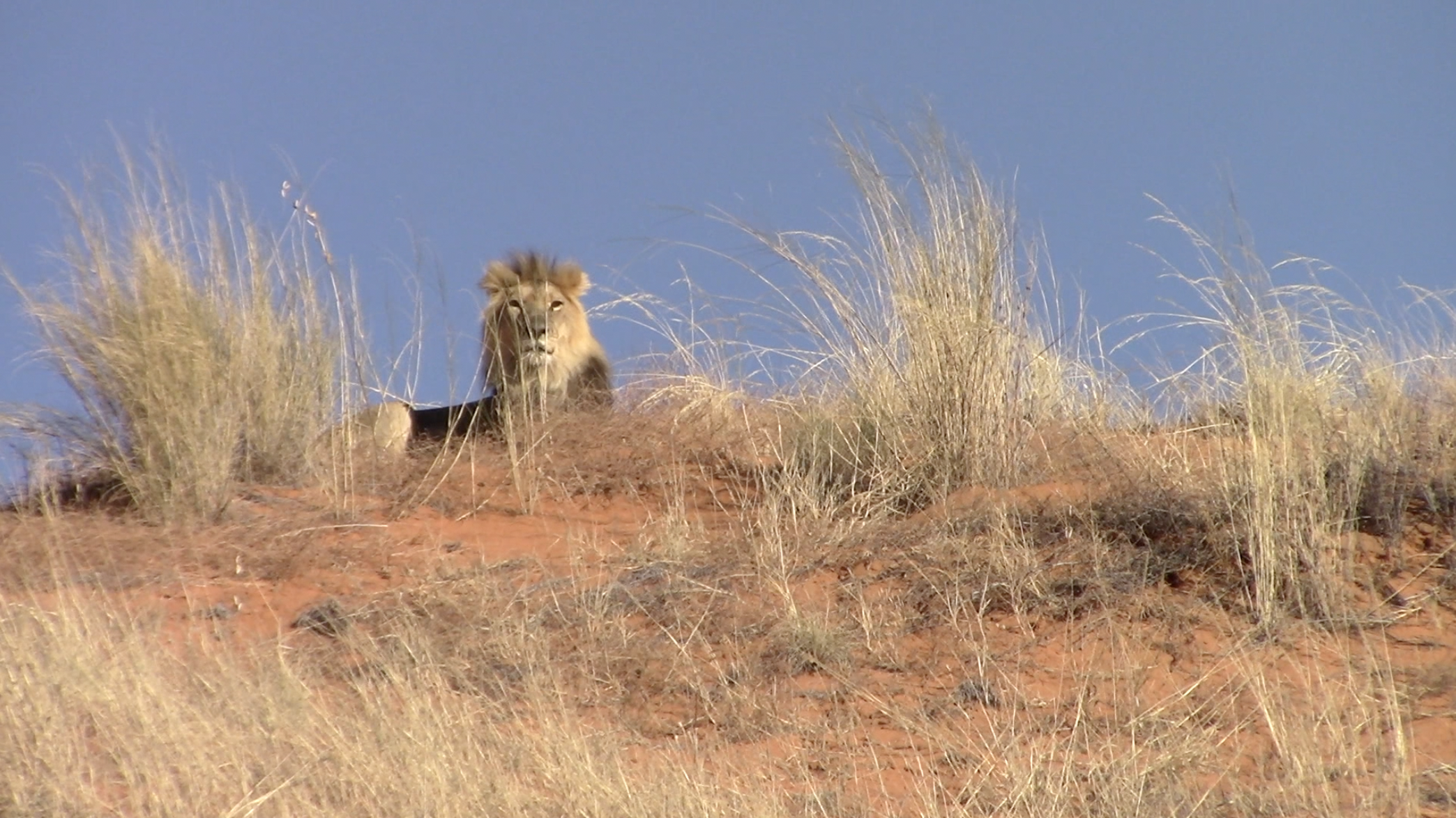
The Kgalagadi Transfrontier Park is Africa’s first cross-border Peace Park and is located in the south of the Kalahari desert. In the year 2000 it officially merged with the Gemsbok National Park in Botswana. It is now almost 40,000 km², almost twice as large as the Kruger National Park. It is one of the largest protected areas in the world. Because there are hardly any gates in and around the park, the animals can move large parts freely when they are looking for water and food. Here you still have a chance to spot wildlife without groups of other people. The park is famous for the impressive red and especially dry landscape with sand dunes and camel thorns. The sun on and under corridors are unforgettable here with giant orange and pink skies.
The two rivers, the Nossob and the Auob, are mostly dry, but you will find most of the park’s vegetation along the beds. This vegetation attracts various species of fauna. Although the Kgalagadi Transfrontier Park is dry, surprisingly many different animals live here, adapted to the Kalahari desert. For example, you see the black-headed Kalahari lion, the cheetah, brown hyena, wild cat, springbok, wildebeest, hartebeest and honey badger. There are also many species of birds of prey such as the fighting eagle, mountain rooster, African steppe eagle and the singing hawk. Although you should always be lucky to see some of the great predators, the Kgalagadi Transfrontier Park gives you a good chance. You can reach the park by car via the R360. It is advisable to drive a 4WD and ensure that there is sufficient water, gasoline and food.
Richtersveld National Park
In the north-west of Richtersveld we find the inhospitable ‘Ai Ais Richtersveld Transfrontier Park‘. The area on the border with Namibia and in the loop of the Orange River seems at first sight an infinite void with the occasional wild rock formation. But nothing could be further from the truth, because there are many small reptiles, birds and in the spring the dry desert area turns into an enchanting flower spectacle.
The highest peak of the national park is the almost 1400 meter high Vandersterberg. The Richtersveld National Park was founded in 1991 to protect a large piece of land. The number of visitors to the park at a time is limited. An agreement was concluded with the indigenous Nama people, which stated that the park would remain their property.
The impressive tubular tree with its extensive system of branches is also a special beautification of the landscape. The dollar plant with leaves resembling coins appears in the central part of the area.
A large number of bird species fly through the deep valleys of the Richtersveld. In total, you will find more than 150 species in the national park, including the Pied Kingfisher, Red-winged Goose, Namakwa Sand Grouse and the Osprey. The dry half-desert is not suitable for large mammals, but for reptiles all the more. No fewer than 25 species of snakes are registered. A meeting with a baboon, klipspringer or ibex is very likely. More rare is the mountain zebra that can count on protection in this area too.
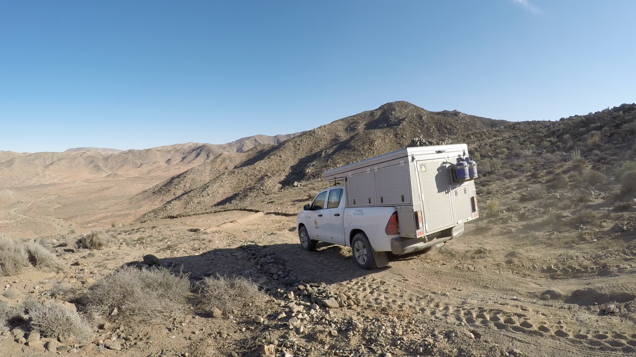
You can cross the rugged landscape of the Richtersveld National Park with a 4WD jeep, but the challenge is probably a lot bigger on foot. In all cases, make sure that you do not get off the paths, because that is rightly seen as a violation. The desert is very fragile. The ‘natural’ paths are often formed by former gold diggers, who came to try their luck here in the 1920s. For experienced hikers or trained climbers there are multi-day hikes on the Vandersterberg.
The sun drenched Kalahari is an often forgotten corner of South Africa. But the breathtaking sunset, the endless rows of red and white dunes, the fertile green fields, red grape vines, historic places and the special flora and fauna make the Kalahari one of the most beautiful places in the country.
It can sizzle with the heat and sometimes it seems like you are the last person on earth in an empty, deserted environment. But all this makes it such a magical place that you will never forget. It hardly rains there, but the plants and animals have adapted perfectly to the sparse environment. Many visitors to South Africa skip the Kalahari but this desert is definitely worth a visit!
The Kalahari is part of a vast steppe that extends from the Orange River to the equator halfway through Africa. Countless, special animals live there. You can come across barking geckos, spoon dogs and puffers among other things. The landscape is generally dry there, except for the Green Kalahari: the area along the river beds.