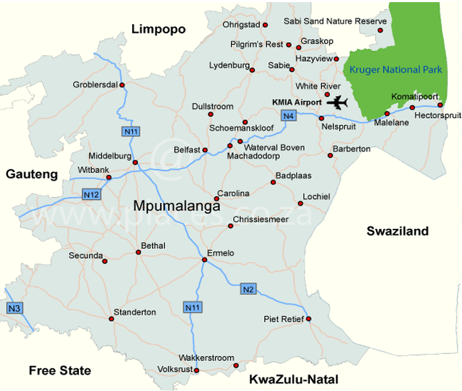
Mpumalanga
The capital of Mpumalanga is Nelspruit and lies on the Crocodile River Valley. Thanks to its location on this river and the subtropical climate, it is very fertile. The area is very wooded and there are all kinds of fruit, exotic plants and flowers growing and it is an important tobacco and wood industry. Nelspruit is a gateway for the sights in Mpumalanga, Kruger National Park and eSwatini (Swaziland). In the city there are various restaurants, cash machines and it is a good location to do your shopping. There is also an airport in Nelspruit.
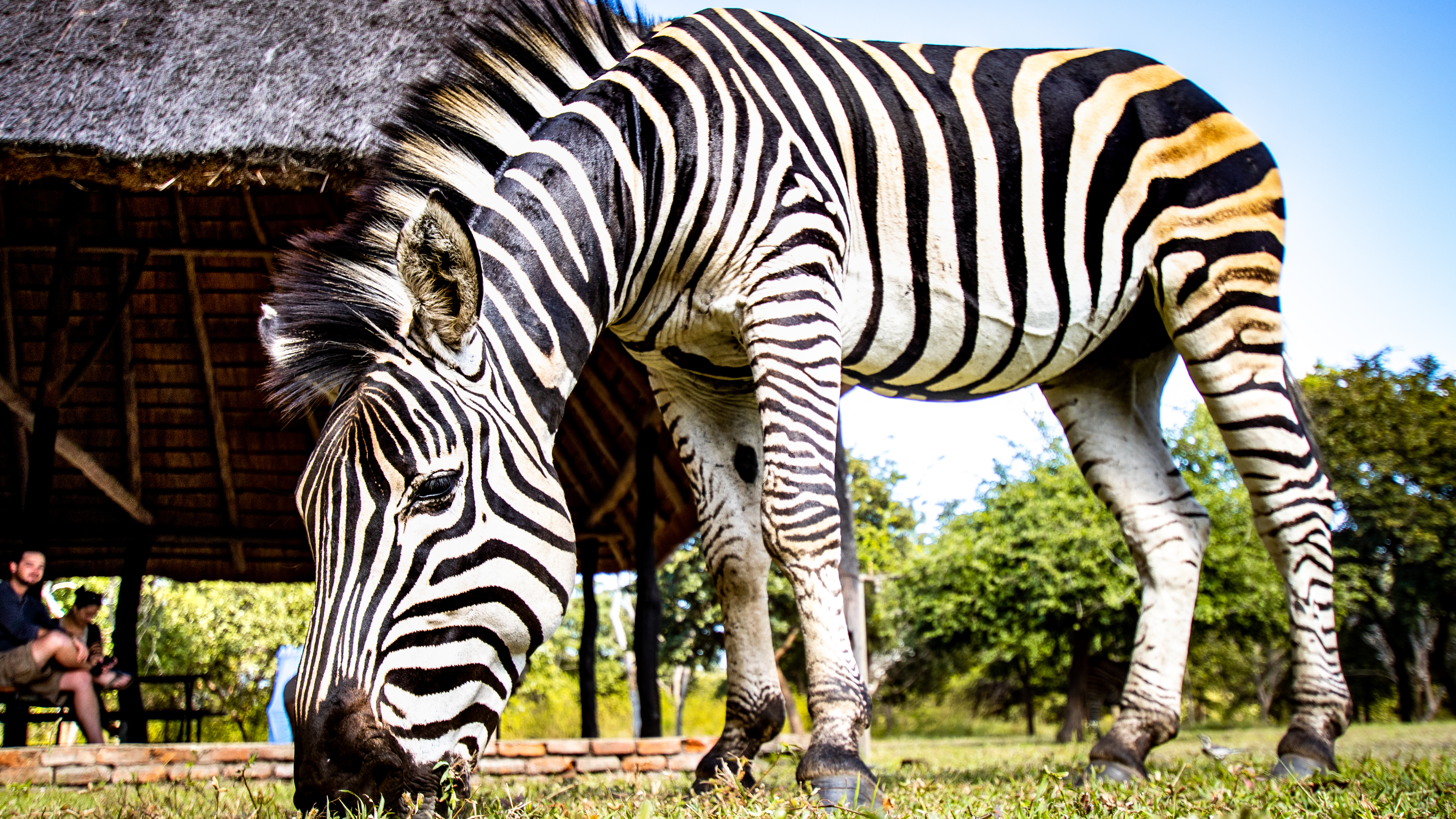
In Mpumalanga you have excellent opportunities for mountain biking, rock climbing, rafting, bungee jumping, ballooning and hiking. You will find rare examples of San rock art in this province. In Botshabelo Historical Village you can learn more about the culture of one of the South African tribes, the amaNdebele. The Shangaan Cultural Village near Hazyview is also very nice to visit to find out more about the Shangaan, Zulu and Thongas and to get to know their music and dance.
Waterfalls route in Mpumalanga
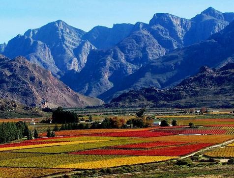
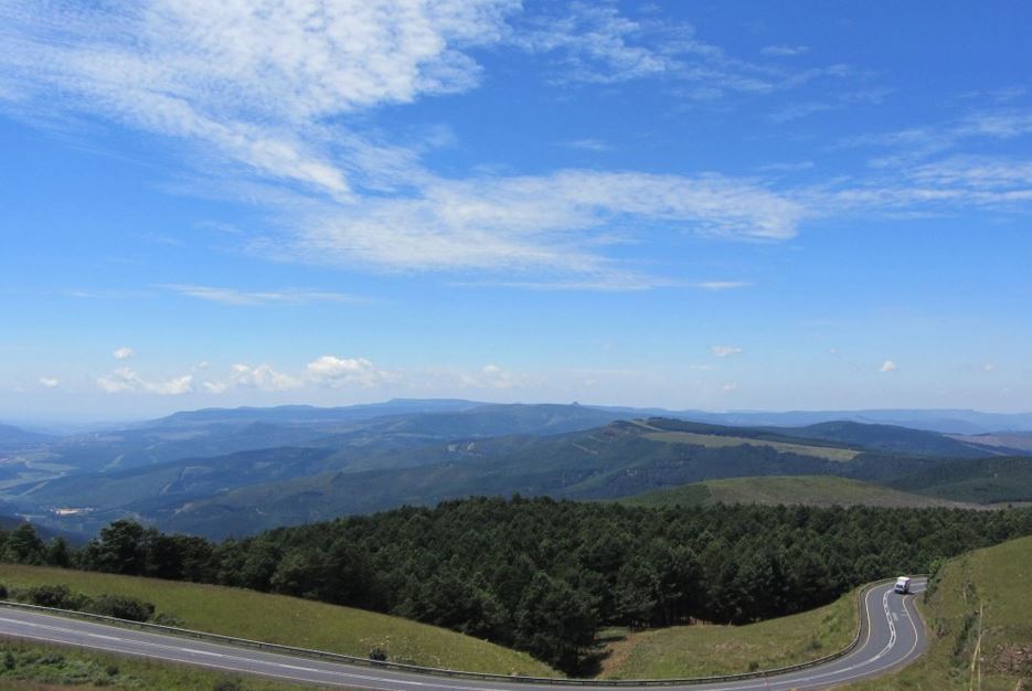
Mpumalanga is high and it rains a lot. Because of this, and due to erosion, spectacular waterfalls have been created. The Waterfalls Route of approximately 100 km takes you past a number of beautiful waterfalls in the old gold mine region between Sabie and Graskop.
Some famous waterfalls are the Horseshoe Falls which owes its name to the shape of a horseshoe, the Lone Creek Falls, the ornate Bridal Veil Falls reminiscent of a bridal veil and the Mac-Mac Falls which are named after Scottish gold diggers. At the Mac-Mac Falls you can have a great picnic and swim in the Mac-Mac Pools which are 3 km away. There are also the Maria Shires Falls, the Lisbon Falls and the Berlin Falls. This last beautiful waterfall flows through a naturally shaped lock before it lands 80 m below in a deep green lake. The Waterfalls Route is located in the east of Mpumalanga near Sabie and Graskop.
Blyde River Canyon Nature Reserve
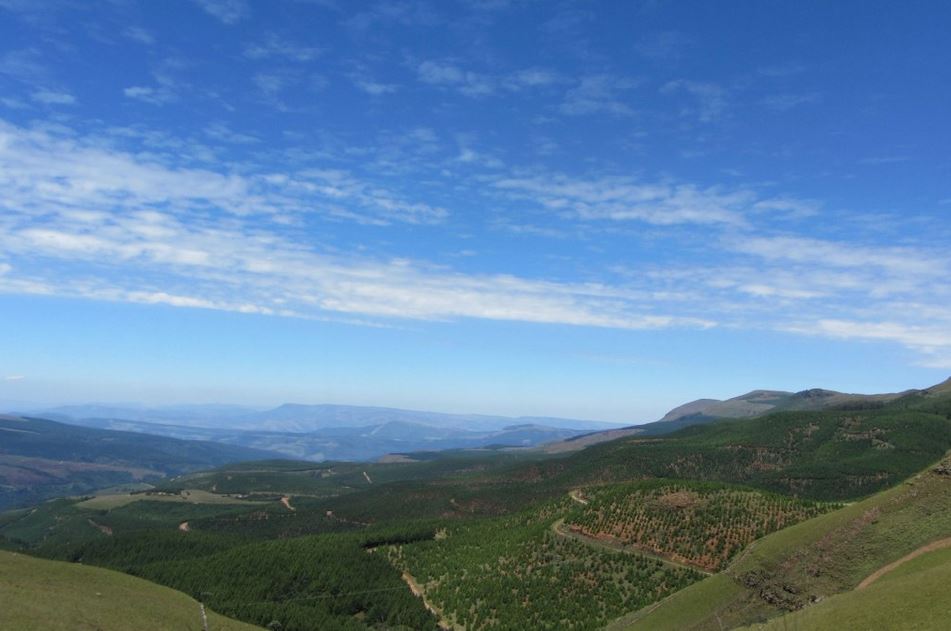
The Blyde River Canyon is a spectacular gorge of no less than 30 km. It is the third largest gap in the world. For centuries, the fast-flowing Blyde River has made its way through an area at an altitude of 700 m that consists of clay soil and quartz rock. Erosion has created an impressive maze of cliffs, islands and rock plateaus that together form the Blyde River Canyon.
A number of very special forms have emerged from this, such as the Pinnacle. This is a giant stone ‘tower’ that seems to come out of the ground. In the stratification of this peculiar pillar you can see its history, once its top was below sea level. There are two fantastic viewpoints nearby: Wonder View and God’s Window. Despite the many tourist stalls, it is really incredibly beautiful here. At God’s Window you are led via a small path to a point where you look out over the plains that are 1000 meters below you.
Other special geological forms in the Blyde River Canyon Nature Reserve along the Panorama Route are the Three Rondavels. These three round hills have many similarities with the traditional huts of the Xhosa tribe. They are worn out by the erosion of soft rock under a kind of cover of harder rock. It seems as if the roofs of the huts so protrude above the gorge.
At the nearby Visitor’s Center you can get more information about the Blyde River Canyon Nature Reserve. A few short, beautiful walks leave from here. You can also take the beautiful 60-mile Blyde River Canyon Hiking Trail that lasts approximately 5 days. This takes you along all kinds of scenic and geological highlights of the Blyde River Canyon.
Pilgrim’s Rest is a living museum that brings you back to the time of the gold diggers. In 1873 Alec “Wheelbarrow” Patterson found gold here and soon some 1500 lucky seekers were looking for it. Pilgrim’s Rest was a gold mining town until 1971 when the last mine, Bete Mine, was closed.
Nowadays it has been restored to its original state and as a visitor you can visit all kinds of houses, restaurants, the post office, the St Mary’s Church and even the cemetery.